Hume City is susceptible to the urban heat island (UHI) effect. This phenomenon occurs in areas with extensive hard surfaces that absorb heat and subsequently release it into the atmosphere, leading to higher temperatures. Additionally, vehicle exhaust and emissions from air conditioners and other energy sources further exacerbate this effect. Hume is ranked number eight in Greater Melbourne in experiencing increased temperature because of the UHI effect. As a result, Hume experiences average summer temperatures 9.23 degrees higher than in non-urban (baseline) areas.
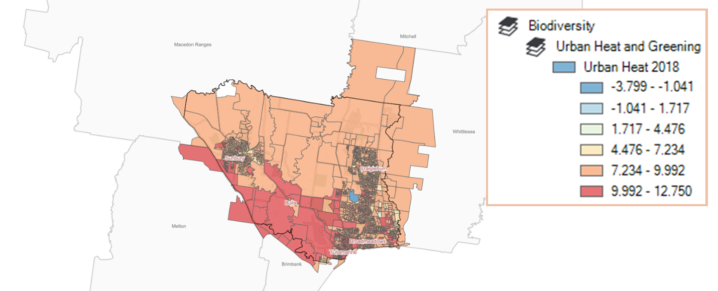
The map below is from Victorian Government urban heat layers from 2018. It shows how many degrees Celsius the average temperature within urban parts of Hume City is above a non-urban baseline. For most of Hume, including green wedge and rural areas, average temperatures are in the range of 7.2-9.9C above a non-urban environment with significant areas around Sunbury and in the urban corridor from Broadmeadows to Craigieburn experiencing more heat on average 9.9-12.7C above a non-urban environment.

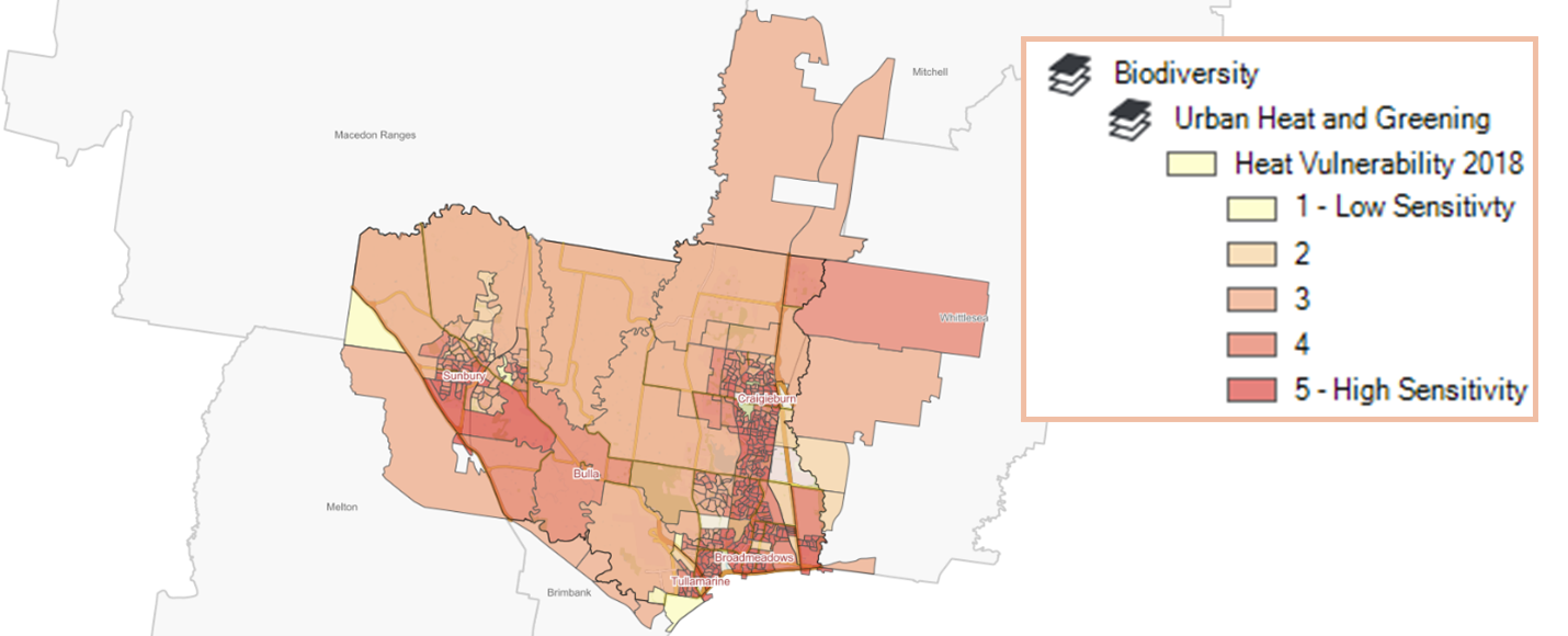
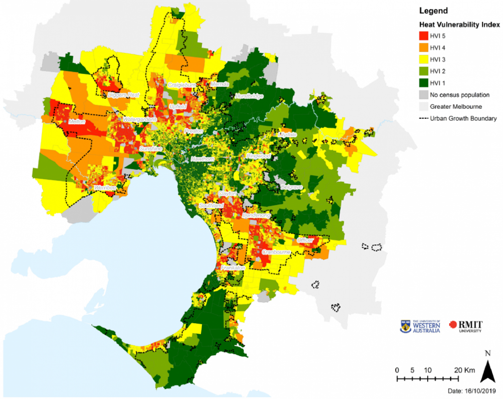
The Heat Vulnerability Index (HVI) identifies which populations are most vulnerable to heat and is determined by three components: heat exposure; sensitivity to heat due to land cover, population density and age; and adaptive capacity including socio-economic advantage or disadvantage. The following map displays how vulnerable populations are to extreme heat events and clearly shows that most of Hume’s population has a high level of vulnerability to extreme heat.

Heat vulnerability index across Greater Melbourne, 2018
